Wikipedia:Graphics Lab/Map workshop/Archive/Apr 2013 Source: en.wikipedia.org/wiki/Wikipedia:Graphics_Lab/Map_workshop/Archive/Apr_2013
Stale
[edit]Make the small islands on map more visible
[edit]-
 Map showing example with different zones
 -
 Map showing international waters in dark blue and exclusive economic zone in light blue
 -
 ie: the map that needs correcting/editing/etc (obvious!)
 -
 base map that could be used in making the requested map


Article(s): United Nations list of Non-Self-Governing Territories#Completely autonomous dependencies
Request: (Concerns improvement of the 3rd map.) Many of the concerned territories consist only of some small islands. The information in this map is color-coded and the small area of the islands makes it hard to actually see, which territories are colored blue and which red (even in this view and when enlarging the view, I think the important information isn't visible very well). Could someone maybe surround the smaller islands with a lighter tone of the respective color, so that there will be larger, lightly colored areas? This could be done by highlighting the territorial waters or exclusive economic zones (see first and second image). -- Toshio Yamaguchi 14:35, 30 January 2013 (UTC)
Graphist opinion:
Updated/better peacekeeping map
[edit]-
 Existing map #1
 -
 Existing map #2
 -
 SVG map


Article(s): Peacekeeping
Request: It would be nice to update those 2008 maps (yes, both, confusing, isn't it)? There is a bunch of nicer, more informative maps on the web, with legends that also give information about mission timeframe, size, and name. See [1], [2], [3] (bottom of the article), [4], [5] or [6]. Piotr Konieczny aka Prokonsul Piotrus| reply here 22:00, 12 January 2013 (UTC)
Graphist opinion: See File:UNpeacekeeping.svg. ResMar 23:05, 2 February 2013 (UTC)
- Thanks. It's up to date, but still less informative then most of the maps I have linked. --Piotr Konieczny aka Prokonsul Piotrus| reply here 00:26, 3 February 2013 (UTC)
- I think the map's just too crowded for adding labels to be particularly effective. ResMar 16:24, 3 February 2013 (UTC)
China townships
[edit]http://chinadataonline.org/cgepublic/cityclient17/# Please could anybody province map with townships borders by this link?--Kaiyr (talk) 16:47, 6 February 2013 (UTC)
For those with spare time: battle maps conversion png to svg
[edit]Hal Jespersen has done a great job in creating battle maps of the American Civil War. But he has uploaded them in png-format. On his site ([7]) he offers the battle maps also in AI-format (Adobe Illustrator). These can be opened in Inkscape. So they can be converted to SVG. For those willing.... Wereldburger758 (talk) 12:05, 19 February 2013 (UTC)
Request: Conversion to SVG
Note that there's an explicit CC-by-3.0 release for the maps. Nyttend (talk) 15:54, 19 February 2013 (UTC)
Graphist opinion(s):
Resolved
[edit]-
 District Map of Tripura

Article(s): Tripura, List of districts of Tripura
Request: The district map of the Indian state of Tripura is available at File:Tripura map.png. However, in 2012, the numbers of districts was increased to eight from four. So, we are in need of a new district map. The new district map can be sourced from this website which is the website of Tripura Industrial Development Corporation. Thanks a lot for the help.--Dwaipayan (talk) 17:33, 29 March 2013 (UTC)
Graphist opinion(s):
![]() Request taken by ► Philg88 ◄
Request taken by ► Philg88 ◄ ![]() talk 06:24, 1 April 2013 (UTC).
talk 06:24, 1 April 2013 (UTC).
![]() ► Philg88 ◄
► Philg88 ◄ ![]() talk 12:56, 1 April 2013 (UTC)
talk 12:56, 1 April 2013 (UTC)

Eurasia map
[edit]-
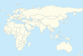 Description of image
 -


Article(s): any
Request: {{Location map}} only has {{Location map Afro-Eurasia}}, it would be nice to have Eurasia only. Regards. Tomcat (7) 13:13, 30 March 2013 (UTC)
Graphist opinion(s):
![]() Request taken by Wereldburger758 (talk) 13:44, 31 March 2013 (UTC).
Request taken by Wereldburger758 (talk) 13:44, 31 March 2013 (UTC).
- Give a definition of Eurasia, please. What is to be included and what not? Wereldburger758 (talk) 13:17, 31 March 2013 (UTC)
- Never mind the question. I searched wikipedia for it. Wereldburger758 (talk) 13:44, 31 March 2013 (UTC)
![]() Done
Done
- Thanks.--Tomcat (7) 14:18, 31 March 2013 (UTC)
Fishing Creek (North Branch Susquehanna River)
[edit]


Article(s): Fishing Creek (North Branch Susquehanna River)
Request: To assist a fellow Wikipedian in their quest to produce a GA article for the above, I produced this push-pin locator map so that the article had some form of map. I am now feeling a bit guilty about how poor it looks, and I feel that I should humbly request a better one for their article. Something similar to the Susquehanna map, would be ideal Jokulhlaup (talk) 17:47, 4 April 2013 (UTC)
Graphist opinion(s):
![]() Request taken by Kmusser (talk) 19:06, 4 April 2013 (UTC)., I did that Susquehanna map so should still have the files to do this one, will hopefully get to it this weekend. Kmusser (talk) 19:06, 4 April 2013 (UTC)
Request taken by Kmusser (talk) 19:06, 4 April 2013 (UTC)., I did that Susquehanna map so should still have the files to do this one, will hopefully get to it this weekend. Kmusser (talk) 19:06, 4 April 2013 (UTC)
Many thanks for picking up this request Jokulhlaup (talk) 17:23, 5 April 2013 (UTC)
- Done, let me know if you need anything else on there. Kmusser (talk) 01:04, 6 April 2013 (UTC)
- Wow, that's an impressive map. Many thanks Jokulhlaup (talk) 17:13, 6 April 2013 (UTC)
Church of the Brethren map
[edit]
Article(s): Church of the Brethren
Request: Some one really needs to take a look at the map for the districts of the Church of the Brethren. Most of it is OK, but North America is covered by two misshapen triangles. It is an obvious error that has been up since 2010.--Bellerophon5685 (talk) 18:00, 14 April 2013 (UTC)
Graphist opinion(s): Done, those triangles haven't been there long if you look at the image history, I updated to a newer version of the world map which fixed that and the South Sudan boundary as well. Kmusser (talk) 19:22, 14 April 2013 (UTC)
Highlight an area in an SVG
[edit]-
 Illinois counties with precincts

Article(s): List of precincts in Illinois, plus a couple of others
Request:
- As you can see at List of precincts in Illinois, there are precincts in Randolph County, but it's not marked on the map; could you highlight it in the same blue as the other counties with precincts? Locator map for Randolph County, so you don't have to look it up. Nyttend (talk) 17:58, 16 April 2013 (UTC)
Graphist opinion(s):
 Done Turns out that 'Randolph' was misspelled in the source, causing it to not show up on the map. Dewclouds (talk) 20:57, 19 April 2013 (UTC)
Locator Map bad alignment
[edit]Article(s): Crimean-Nogai Raids
Request: 1. Something in the below Locator map is causing misalignment as noted in caption. Benjamin Trovato (talk) 23:59, 12 April 2013 (UTC)

Benjamin Trovato (talk) 23:59, 12 April 2013 (UTC)
Graphist opinion(s): The "position=bottom" after Elezavetgrad is what's causing the problem, change that to "position=right" like the others. Kmusser (talk) 18:34, 13 April 2013 (UTC)
- Reply: I just tried that and it did not work. 2. added good version. Benjamin Trovato (talk) 21:34, 13 April 2013 (UTC)
- I added a second example Benjamin Trovato (talk) 12:14, 19 April 2013 (UTC)
- Fix was the same. Kmusser (talk) 13:32, 19 April 2013 (UTC)
- Replaced with better example. Problem is paired line-feeds as indicated on the map label.Benjamin Trovato (talk) 06:29, 22 April 2013 (UTC)
- I don't understand what you are trying to do here. Yes, adding blank lines messes up the template, so don't do that. Kmusser (talk) 08:37, 22 April 2013 (UTC)
- 1. Why should a blank line in source code change the output? No other language does that. 2. I can't think of a reason why anyone would want to push a map location south of its correct lat/long. Therefore its a bug, not a feature. 3. Anyone who adds a blank line must either trace the bug or produce an incorrect map. 4. Person who wrote the underlying code should be informed so he can see what the problem is. A visible bug sometimes implies invisible bugs. Benjamin Trovato (talk) 22:15, 22 April 2013 (UTC)
- Ah, this is a forum for fixing maps, not debugging templates, you want Template_talk:Location_map. Kmusser (talk) 19:53, 23 April 2013 (UTC)
- Request has been moved to the above location and they are looking at it, so this section can be archived or deleted. Thanks. Benjamin Trovato (talk) 21:38, 24 April 2013 (UTC)
- Ah, this is a forum for fixing maps, not debugging templates, you want Template_talk:Location_map. Kmusser (talk) 19:53, 23 April 2013 (UTC)
- 1. Why should a blank line in source code change the output? No other language does that. 2. I can't think of a reason why anyone would want to push a map location south of its correct lat/long. Therefore its a bug, not a feature. 3. Anyone who adds a blank line must either trace the bug or produce an incorrect map. 4. Person who wrote the underlying code should be informed so he can see what the problem is. A visible bug sometimes implies invisible bugs. Benjamin Trovato (talk) 22:15, 22 April 2013 (UTC)
- I don't understand what you are trying to do here. Yes, adding blank lines messes up the template, so don't do that. Kmusser (talk) 08:37, 22 April 2013 (UTC)
- Replaced with better example. Problem is paired line-feeds as indicated on the map label.Benjamin Trovato (talk) 06:29, 22 April 2013 (UTC)
- Fix was the same. Kmusser (talk) 13:32, 19 April 2013 (UTC)
- I added a second example Benjamin Trovato (talk) 12:14, 19 April 2013 (UTC)

Anglican Communion map
[edit]
Got alot of issues with this map that I have been trying to draw attention to.
- 1. Some areas are gray, when they should be blue because they are served by the Episcopal Church (United States).
- a. Venezuela, Colombia, Ecuador, Honduras, the Dominican Republic and Puerto Rico are part of Province 9 of the Episcopal Church in the United States of America
- b.Haiti, the US Virgin Islands and the British Virgin Islands are part of Province 2 of the Episcopal Church in the United States of America
- c. Guam and the Northern Marianas are part of Province 8 of the Episcopal Church in the United States of America, like Taiwan, which is blue.
- 2. Nepal and the Central African Republic are blue, but I cannot find a RS saying that they are served by an AC member. The most logical AC affiliates, the Church of North India and the Anglican Church of the Congo do not have responsibility for the CAR, that I can find.
- 3. Rwanda, which does have an AC affiliate, the Anglican Church of Rwanda appears to be grey on the map.
- 4.

- a.It shows Iraq, and Yemen as grey, though the map for the Episcopal Church in Jerusalem and the Middle East clearly shows Iraq and Yemen as part of the Anglican Diocese of Cyprus and the Gulf.
Their own website clearly shows a presence in both countries.
http://cypgulf.org/diocese-directory/map-of-the-diocese/
- b.The Palestinian territories, apparently represented with a grey dot in the Anglican Communion map, are colored light blue in the Episcopal Church in Jerusalem and the Middle East map, indicating that they are served by the Anglican Diocese of Jerusalem. And by all accounts, that diocese is supposed to cover the Palestinian territories.
- 5. And there is Europe. There are a number of issues here, mostly due to the overlapping jurisdictions of the Church of England affiliated Diocese of Gibraltar in Europe and the ECUSA affiliated Convocation of Episcopal Churches in Europe as well as the presence of the Porvoo Communion and Union of Utrecht (Old Catholic) churches.
- a.The Diocese of Gibraltar map, the Anglican Communion map and the Diocese of Gibralter website each seem to be saying different things.

http://europe.anglican.org/who-we-are/archdeacons
I'll go with the diocesan website as the accurate one. Now according to this site the Archdeaconry of of France serves both France and Monaco. The archdeacon of Gibraltar serves Gibralter, Andorra, Spain, Portugal, Morocco, Madeira and the Canary Islands. The archdeacon of Italy and Malta serves those countries and the Archdeaconry of Northwest Europe includes the Netherlands, Belgium and Luxembourg. Putting aside, for a moment, the Western European countries that have Old Catholic affiliates, Monaco, Malta, Andorra, Belgium, Luxembourg, Madeira and even Gibraltar itself are grey.
- b. The eastern archdeaconry includes a broad area, most of which is grey in the map. The archdeacon himself has special responsibility for Austria, Slovenia, Croatia, Hungary, the Czech Republic and Slovakia. Another area dean has responsibility for Turkey, Greece, Bulgaria, Romania, Albania, Macedonia, Serbia, Montenegro and Bosnia. And finally another dean is assigned "Chaplaincies in the former Soviet Union (excepting the Baltic States), Poland and Mongolia" (despite our map for the Diocese of Gibraltar and Europe showing Kazachstan as white)
- c. The Northern archdeaconry includes Germany and "Nordic and Baltic States: includes Norway, Sweden, Denmark, Finland, Estonia and Latvia" (despite what it shows on our map for the Diocese of Gibraltar and Europe, there is no specific mention of Iceland, the Faeroe Islands or Lithuania.)
- d. The US affiliated Convocation has a different structure listed here
http://www.tec-europe.org/parishes/index.html
They have a presence in France, Germany, Belgium, Italy, Austria, Switzerland and even Almaty, Kazakhstan.
Now we could handle this a couple of ways. We could stripe the areas with a Porvoo/Utrecht affiliate blue/ green and blue/red to show that there is an Anglican proper presence in the country. We could also use insets for Europe, showing the overlapping jurisdictions of the Diocese of Gibralter and the Convocation of Euorpean churches. But in any case, Gibraltar, Belgium, Austria and Malta need to be blue as the Anglican affiliates certainly have a physical presence there
I'm sorry if I'm over thinking this, its just been bugging the hell out of me for awhile.--Bellerophon5685 (talk) 18:00, 14 April 2013 (UTC)
Map of the world (part) in global perspective
[edit]Request: I am in need of a maps (or maps) like the one here: [8]. These kind of maps can be found here on wikipeda and on wikimedia, but I cannot find them. What is the category that they are placed under? Wereldburger758 (talk) 05:55, 21 April 2013 (UTC)
Graphist opinion(s): I found them: [9] but it took me a long time to find them. Wereldburger758 (talk) 06:16, 21 April 2013 (UTC)
Map of the Motorways in the Republic of Ireland
[edit]

Article(s): Motorways in the Republic of Ireland
Request: The first image is currently used in the article and it just includes all roads in Ireland (and is also outdated). Is it possible for someone to create just a map showing the motorways in the Republic? I included a map of something similar which is done for motorways in the UK. There are currently 12 motorways in Ireland, this map will help brighten up the article. Thanks Rctycoplay (talk) 23:52, 8 February 2013 (UTC)
Graphist opinion:

My first one... Is this along the lines you were thinking? Arc is producing those white lines so I'll just make it a png... but before doing that, did I miss any, and would you like any other ROI road maps?. PhnomPencil (talk) 18:12, 18 April 2013 (UTC)